Skip to content
Civil Tracker
  • IndustriesExpand
    • Landfills and Waste Management
    • Aggregate Sand and Gravel
    • Municipal Services
    • Mining
  • ProductsExpand
    • How Civil Tracker Works
    • Ground Control Points as a Service
  • LearnExpand
    • Our Insights
    • Our Expertise
    • Our Technology
    • Support
  • Pricing
  • Contact
  • Login
  • Sign Up
Civil Tracker

Keep up to Date with our Insights

Drone | Getting Started | Survey | Training

Fly & Collect Great Drone Mapping Data

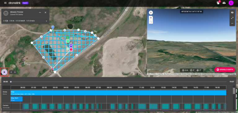
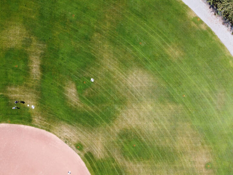
In our previous article, we created a drone mapping plan. If you don’t have a mapping plan yet, go back and checkout this article for some helpful tips How to Make the Perfect Dronelink Mapping…

Read More Fly & Collect Great Drone Mapping DataContinue

Dronelink-simulation-run
Drone | Getting Started | Training | Video

Make a Perfect Dronelink Mapping Plan in 9 Steps

To create a drone map you need a drone, an autopilot app and mapping software (that’s Civil Tracker). We previously helped you chose a drone. If you missed that and don’t yet have a drone…

Read More Make a Perfect Dronelink Mapping Plan in 9 StepsContinue

Mavic 3 Enterprise
Drone

4 Best Mapping Drones of 2024

With numerous mapping drones on the market, choosing the right one can be hard. We’ve come up with a list of things to consider when purchasing a mapping drone. As a bonus, we’ve also included…

Read More 4 Best Mapping Drones of 2024Continue

All About Ground Control Points
Survey | Drone | Training

All About Ground Control Points

What are Ground Control Points, and What Purpose Do They Serve? Ground Control Points (GCPs) are large photo-identifiable targets that are placed on the ground within the boundary of your drone survey.  GCPs are the…

Read More All About Ground Control PointsContinue

DJI Autopilot App
Drone

9 Best DJI Drone Autopilot Apps

With so many DJI drone autopilot apps on the market, it can be difficult to pick the best one for your mapping needs. Our goal is to review the differences between apps, and how they…

Read More 9 Best DJI Drone Autopilot AppsContinue

Autel Nano and Nano+ Drone
InTheNews | Regulatory | Survey

Can I Map and Survey with the Autel Nano and Nano+

In September Autel Robotics announced their Autel Nano and Nano+ drone. The Autel Nano and Nano+ are two versions of a micro drone. Each weighs just under 250g and will compete with the DJI Mavic…

Read More Can I Map and Survey with the Autel Nano and Nano+Continue

Drone Image of a Baseball Diamond
Support | Getting Started | Training

How to Make Great Drone Maps

So you want to improve your drone mapping and make great drone maps? While making quality maps isn’t too complex, there are a few things you should be aware of before you launch your drone….

Read More How to Make Great Drone MapsContinue

Civil Design Surface Cut Fill
Monitoring | Reporting | Support | Waste Management

Civil Design Surface Cut Fill

Compare your drone survey with your civil design surface to find cut and fill elevations and volumes One key to effective construction and site management is the ability to accurately know how much work is…

Read More Civil Design Surface Cut FillContinue

Drone Hill shade with GPS Check Points showing high accuracy results
Client Stories | ROI | Survey

How Accurate is Mapping with the DJI Mavic Mini?

Previously in Can I Map and Survey with the Mavic Mini we showed an accuracy study, but we wanted to follow up with more. Why you ask? As you know, our nature is to push…

Read More How Accurate is Mapping with the DJI Mavic Mini?Continue

Can I Map and Survey with the Mavic Mini?
Survey | ROI

Can I Map and Survey with the Mavic Mini?

Spoiler Alert! Yes, You Can. With Civil Tracker you can map and survey with the Mavic Mini, Mini 2 and Mini SE. We believe a whole new generation of drone mappers is about to start…

Read More Can I Map and Survey with the Mavic Mini?Continue

Page navigation

Previous PagePrevious 1 2 3 4 Next PageNext

Categories
  • Client Stories (4)
  • Drone (11)
  • Getting Started (5)
  • InTheNews (1)
  • Monitoring (7)
  • Regulatory (7)
  • Reporting (9)
  • ROI (5)
  • Support (9)
  • Survey (16)
  • Training (13)
  • Video (4)
  • Waste Management (3)

Does your surveyor have this view of your earthworks project? Now they can
Twitter Linkedin

© 2025 Civil Tracker

  • Privacy
  • Terms and Conditions
  • Industries
    • Landfills and Waste Management
    • Aggregate Sand and Gravel
    • Municipal Services
    • Mining
  • Products
    • How Civil Tracker Works
    • Ground Control Points as a Service
  • Learn
    • Our Insights
    • Our Expertise
    • Our Technology
    • Support
  • Pricing
  • Contact
  • Login
  • Sign Up
Twitter Linkedin