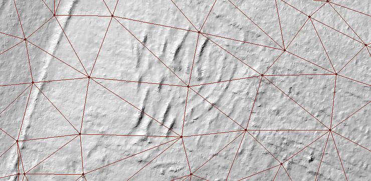
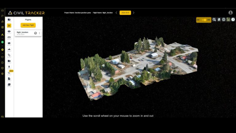
Skip to content
Civil Tracker Logo
  • SolutionsExpand
    • Aggregate Sand and Gravel
    • Municipal Services
    • Landfills and Waste Management
    • Mining
  • ProductsExpand
    • How Civil Tracker Works
    • Ground Control Points as a Service
  • LearnExpand
    • Our Insights
    • Our Expertise
    • Our Technology
    • Support
  • Pricing
  • Contact
  • Login
  • Sign Up
Civil Tracker Logo

Reporting

Civil Design Surface Cut Fill
Monitoring | Reporting | Support | Waste Management

Civil Design Surface Cut Fill

Compare your drone survey with your civil design surface to find cut and fill elevations and volumes One key to effective construction and site management is the ability to accurately know how much work is…

Read More Civil Design Surface Cut FillContinue

Level Up on Progress Monitoring with 3rd Generation Drone Data Analytics
Monitoring | Reporting

Level Up on Progress Monitoring with 3rd Generation Drone Data Analytics

Civil Tracker is leading the industry with its innovative 3rd Generation earthworks tracking technology for drone users. Want to understand the pros and cons of each generation of tools? Keep Reading…

Read More Level Up on Progress Monitoring with 3rd Generation Drone Data AnalyticsContinue

Civil Tracker Beta-App Demo Video
Monitoring | Reporting | Video

Civil Tracker Beta-App Demo Video

Read More Civil Tracker Beta-App Demo VideoContinue

Responsive vs. Determinate Earthworks Progress Monitoring
Monitoring | Reporting

Responsive vs. Determinate Earthworks Progress Monitoring

The two ways of tracking change on a construction project are the responsive method and the determinate method. It’s important to understand the difference between the two and choose the best solution for your construction…

Read More Responsive vs. Determinate Earthworks Progress MonitoringContinue

Drone Accuracy – Why More Data is Better
Reporting | Survey

Drone Accuracy – Why More Data is Better

Have you wanted to use Drones for your earthworks as-built surveys, but been unsure about the accuracy and quality? You’re not alone. Civil Tracker’s market research shows that despite the proliferation of drones the large…

Read More Drone Accuracy – Why More Data is BetterContinue

Why Earthworks Is (not) Easy
Reporting | Survey

Why Earthworks Is (not) Easy

Earthworks is an often undervalued piece of the overall construction project. I can’t tell you how many times I’ve heard “Earthworks is Easy”, usually expressed by people who don’t know a thing about it. Any…

Read More Why Earthworks Is (not) EasyContinue


Categories
  • Client Stories (2)
  • Drone (2)
  • Getting Started (1)
  • InTheNews (1)
  • Monitoring (4)
  • Regulatory (4)
  • Reporting (6)
  • ROI (5)
  • Support (2)
  • Survey (8)
  • Training (3)
  • Video (2)
  • Waste Management (3)

Does your surveyor have this view of your earthworks project? Now they can
Twitter Linkedin

© 2023 Civil Tracker

  • Privacy Policy
  • Terms and Conditions
  • Solutions
    • Aggregate Sand and Gravel
    • Municipal Services
    • Landfills and Waste Management
    • Mining
  • Products
    • How Civil Tracker Works
    • Ground Control Points as a Service
  • Learn
    • Our Insights
    • Our Expertise
    • Our Technology
    • Support
  • Pricing
  • Contact
  • Login
  • Sign Up
Twitter Linkedin
Search