How Civil Tracker Works
A sneak peak to our coolest tools
View, Measure, and Act in a few easy steps.
Start using Civil Tracker as soon as you’ve landed your drone. Simply upload raw imagery (jpg format) from your drone. Then start getting insights on your project!
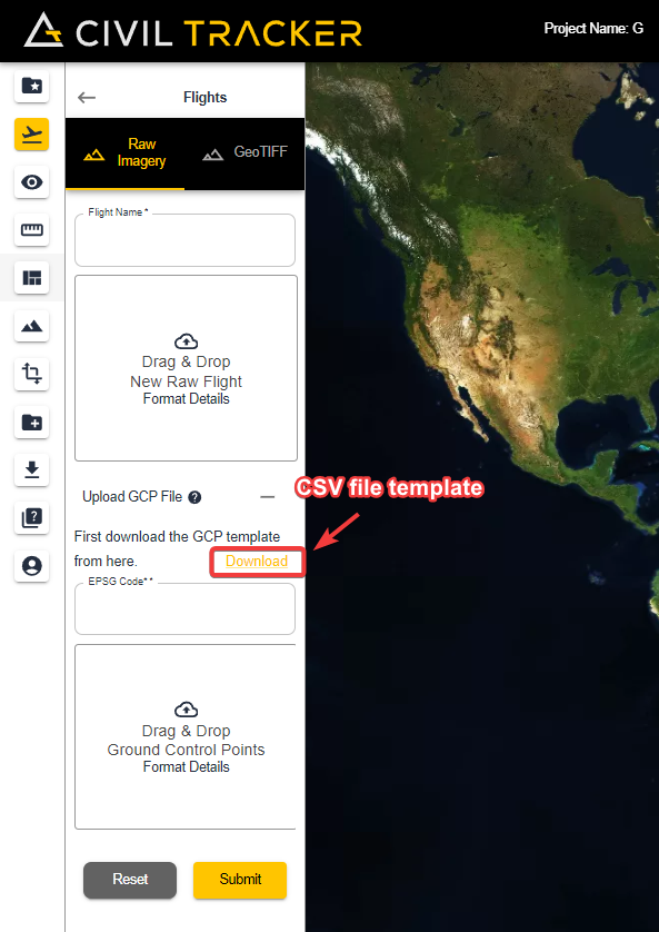
Upload Drone Data
Create a new project or add a new flight to an existing project. If you have Ground Control Points upload them for high-accuracy results (CSV file)
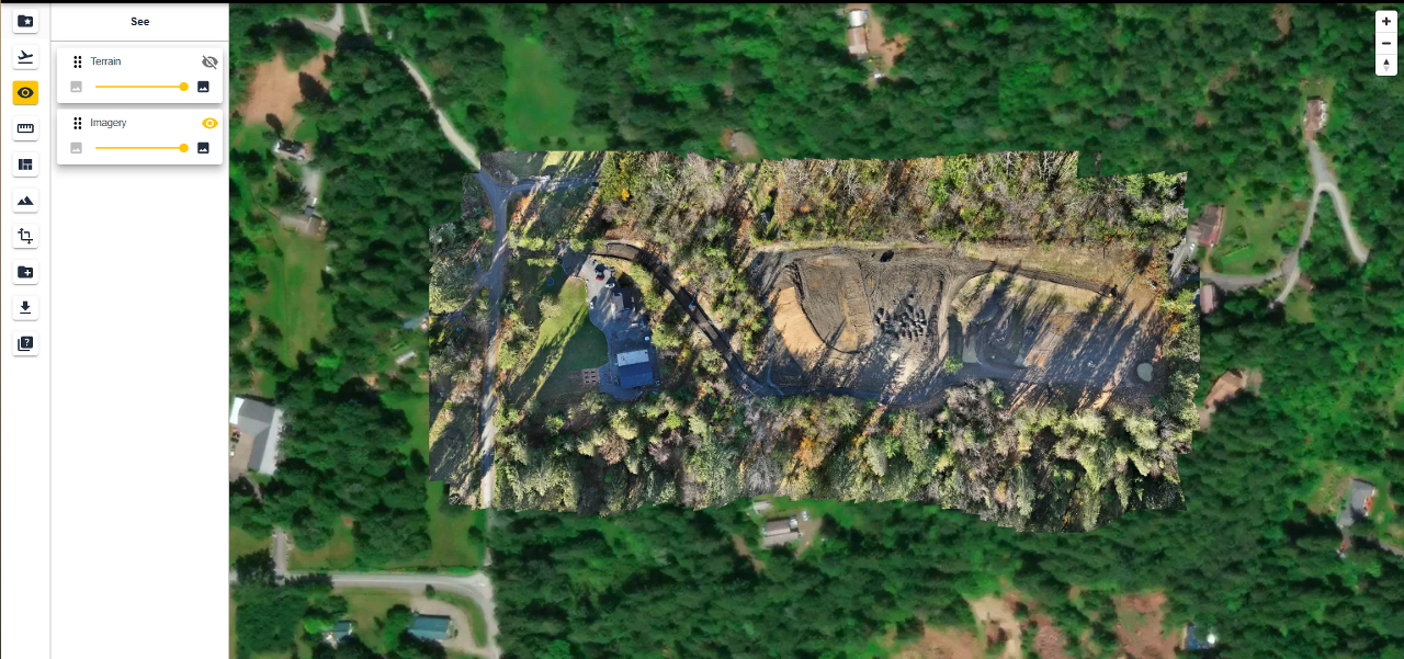
View Your Results
Jump into your newly created map to view imagery up to 10 times better than anything Google Earth can offer. Switch to the Terrain view to see the slopes, hills and valleys within your map.
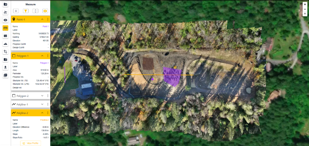
Measure
Measuring has been made easy with Civil Tracker. Virtually survey the coordinate and elevation of any object on the map. Check slopes and distances using the line tool. Finally; stockpile volumes, areas and perimeters are easily measured with the polygon tool.
Get Started Now!
Pair your drone with Civil Tracker software platform to visualize, measure and track your site. It’s never been easier or cheaper!
Get started by signing up for a free Civil Tracker trial. Or connect directly to ask questions and learn more.