Adding New Flights
If you want to add a flight to a project, go to the project page at Civil Tracker and follow these steps.
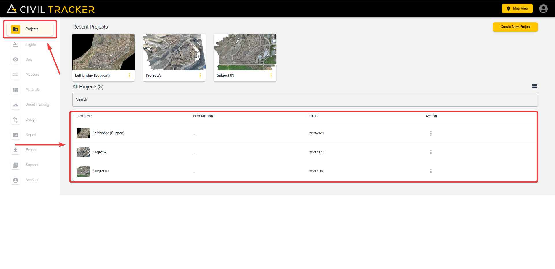
Step 1
From the Dashboard, Select the project you want to upload a flight in by clicking on the project under the project tab.
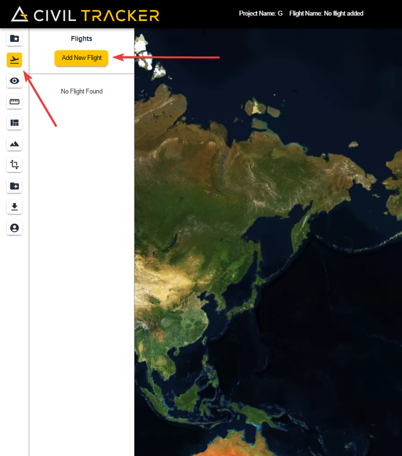
Step 2
After selecting your project, Go to the “Flights” tab and click on “Add New Flight”
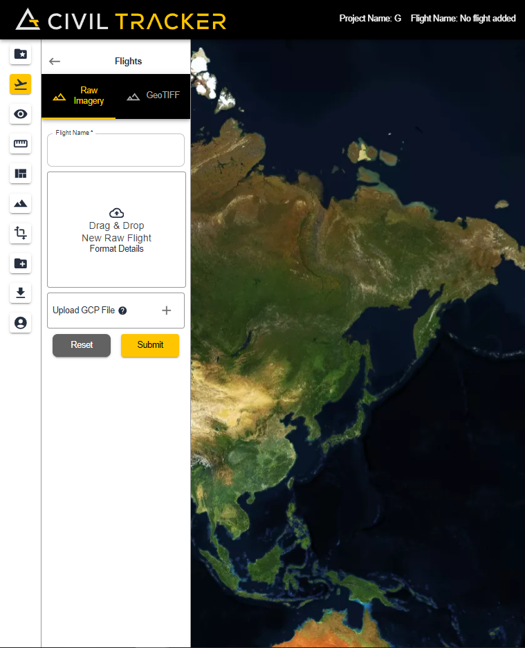
Step 3
Here you will get two options. You can either upload a GeoTIFF(Processed flight) or Raw Imagery.
- Raw Imagery is the photos collected during the drone flight. When uploaded to Civil Tracker, the images ares processed into the Elevation Model and the Orthomosaic. Flights will be processed within 24 hours of upload.
- GeoTIFF is pre-processed raster data (Image & elevation model) that you can upload into your project to use features like cut/fill, measure and smart tracking. The processing time for a GeoTIFF flight is around one hour.
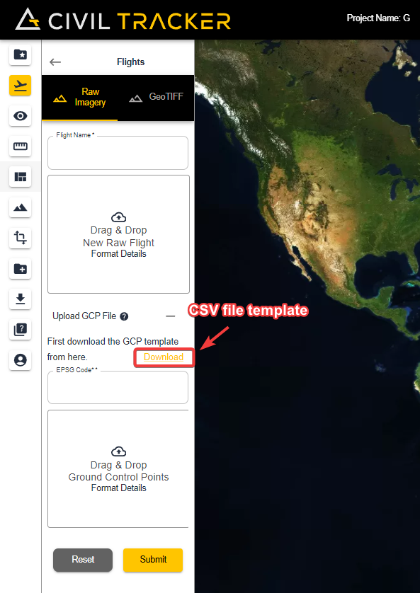
For a raw upload, you need the following:
- Raw imagery from your drone.
- GCP File (csv) – For a GCP Flight, upload the GCP file along with the EPSG code after uploading the images. For the GCP File, please download the “template” provided for the csv file and adjust your file accordingly.
- For a Non-GCP Flight, click “submit” after adding the images.
After you have added the images, enter your EPSG code and uploaded the csv file, your screen should look like this
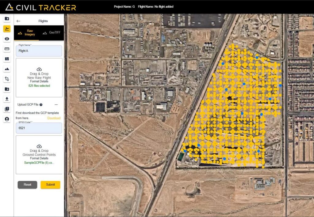
The yellow dots represents the position of your images and the light blue dots represent the position of your Ground Control Points. This will help you confirm the location and orientation of both your images and the GCP’s.
That’s it!
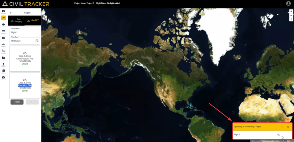
After clicking “submit” , your flight will start to uploading and you will be able to see the progress in the bottom right corner.
Once uploaded just wait 24 hours for your flight to be processed.
Pro Tip.
- DO NOT close your browser during the upload; the upload will fail, and you will need to upload again.
- Once your flight is processed and ready to view, you will receive an email from support@civiltracker.xyz
If you ever get stuck or need help, reach out to us at support@civiltracker.xyz