Drone Program Startup List
For Permanent Mavic Mini with Permanent GCPs
What You’ll Need
- Civil Tracker Account
- Windows or Mac computer with a modern browser
- Mavic Mini Fly More Kit
- Micro SD Card
- Dronelink App purchased and installed
- DJI Fly App installed (free)
- Landing and take off pad
- iOS or Android Tablet or Phone
- DJI Care Refresh Package (recommended)
- Patio Blocks for Permanent GCPs (10-15 for typical site)
- Black and White Paint or Vinyl Flooring Tiles & Construction Grade Glue
- Civil Tracker GCP-as-a-Service Kit or your own RTK GPS
Civil Tracker Signup
Signup for your Civil Tracker account.
Computer
Any computer with a modern browser such as Chrome or Firefox will work with both the Civil Tracker and Dronelink web applications. Traditional drone survey platforms require powerful computers to process drone data into imagery and terrain models. However, with Civil Tracker the processing is done on our powerful computers allowing you to use a regular laptop or desktop.
Mavic Mini Fly More
There are many great drone options. If you’re using another drone no-worries, just ignore this step and move down.
The Mavic Mini is available for purchase at many places. If buying a Mavic Mini the Fly More kit is definitely worth the extra cost. The extras includes are a charger, 2 batteries and extra props.

Micro SD Card
The Mavic Mini does not come with a memory card so buy one or two. Generally buying a good quality card is more important than buying a big card. 160 acres of mapping will likely only take 5 to 7 GB of data. Most cards you’ll buy will be 32 or 64 GB. For further reading check out The Best Micro SD Card For DJI Mavic Mini.

Autopilot App
Dronelink is the autopilot app used to fly mapping grids and collect regularly spaced photos with your drone. These are the photos that Civil Tracker will process into a single ortho-image and 3D terrain. Purchase the Dronelink app and learn to use their webapp on your computer and native app on your device.
DJI Fly App
The Fly App is the main app provided by DJI for use with the Mavic Mini. You will use this app to update firmware, complete manual test flights, calibrations etc. However, you will not use this app to complete mapping grid flights. The Fly App is free and available through either the Apple App Store or Google Play Store
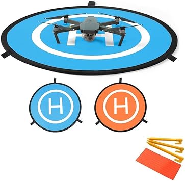
Takeoff & Landing Pad
The Mavic Mini is a very low profile drone with the camera and propellers very close to the ground during takeoff and landing. It’s a good idea to have a piece of plywood, hard plastic or a specially made take off and landing pad to protect your drone from dust and debris. Your Ground Control Points can be great places to take off and land.
Smartphone or Tablet Device
A smart phone or tablet is only required to operate the drone not to use Civil Tracker. Generally dronelink recommends using a device that is two years old or newer and has more information in their support documents.
DJI Care Refresh Package (recommended)
While not required, we highly recommend purchasing the DJI Care Refresh Package within 48hours of first powering up your drone. It’s an inexpensive and worthwhile warranty.
Patio Block For Permanent Ground Control Points
The goal with permanent GCPs is to have them last long time and not move. We’ve found that patio blocks are the most universally available and cost effective solution. Generally available from any hardware store. The most common sizes are 24″ x 24″ or 24″ x 30″. Either will work perfectly well.

Paint or Vinyl Tiles For Marking Ground Control Points
Ground Control Points must be marked in a black and white checker pattern. The easies solution is to install vinyl flooring tiles and supplement the adhesive with construction glue such as PL400. A slightly cheaper and messier means is to buy Black and White paint. Either way the key is to have straight lines and clearly defined center point.

Civil Tracker GCP-as-a-Service Kit or your own RTK GPS
Now that you have your GCPs installed and marked we need to establish accurate surveyed positions. If you have your own RTK GPS that can be used. However, most operators will not have a survey grade GPS system and can use Civil Tracker’s GCP-as-a-Service.
Additional information can be supplied for each of these steps. This list is designed as a guide.