Easily import KML and KMZ files from CAD and GIS into Civil Tracker
You can now import points, lines, and polygons using the KML and KMZ formats from CAD, GIS, and Google Earth thanks to our brand-new feature (beta)! Overlay your extremely high definition drone footage and terrain models with your property boundaries, topographic features, building layouts, and much more.
Just export a KML or KMZ from Autodesk Civil 3D, Global Mapper, Google Earth etc. and import it into Civil Tracker. Unlike shapefiles, KML and KMZ files can retain line color, thickness and fill making the visibility of the imported data the same as how it was exported.
Use Cases
There are many uses for adding CAD and GIS data to your Civil Tracker projects. Below are a few examples from our clients.
Property Development
Adding property boundary maps, utility, planning and environmental data into Civil Tracker allows project developers to plan and manage their projects from the early vision stages, through design, approvals and into construction.
Construction
Importing design data such as foundation drawing, floor plans, roads and utilities allows the construction manager to plan and execute the project. Anticipating challenges well in advance reduces cost and keeps projects both on schedule and on budget.
Resource and Land Use Planning
Accurate linework is essential for infrastructure planning, such as designing roads, utilities, and buildings. It aids in resource management by clearly defining areas for different uses, such as agricultural fields, forest boundaries, and conservation areas.
Why KML and KMZ File Types?
There are three main reasons Civil Tracker chose to support KML and KMZ file types first.
KML and KMZ formats are very common and open. Almost all GIS, CAD and Mapping software now supports exporting to KML/KMZ. The format is spatially aware. This means it will always show up in the right spot in the world, unlike a DXF/DWG file which could be on arbitrary coordinates in the middle of the Ocean. Finally KML and KMZ support line styles and colors. This means the import should look very similar to the export. Unlike shp files which don’t support any style and formatting.
But don’t worry. We intend to support more file types over time. In the meantime free tools such as Google Earth and QGIS can be used to style and convert data and export it as a KML or KMZ.
The Importance of Linework for Mapping
Linework in drone mapping is vital for achieving high accuracy, clarity, integration with other data sources, efficient planning, regulatory compliance, enhanced visualization, data consistency, and support for advanced analytics. These factors collectively contribute to the effectiveness and reliability of drone mapping projects.
Linework helps in precisely defining the boundaries of different features such as property lines, roads, and water bodies. This is essential for accurate mapping and surveying. It ensures that features are accurately delineated, which is important for detailed analysis and decision-making processes.
Linework simplifies complex data by providing clear outlines of features, making maps easier to read and interpret. Different line styles and weights can be used to create a visual hierarchy, distinguishing between major and minor features.
It enhances the aesthetic quality of maps, making them not only functional but also visually appealing. It also helps in reducing errors by providing a clear and consistent method for representing features.
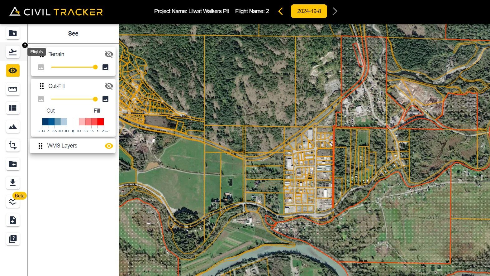
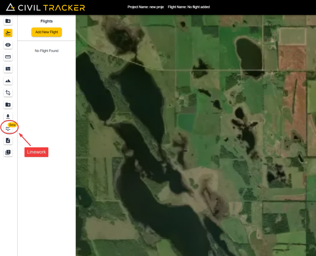
Import KML into Civil Tracker
To upload your Linework on Civil Tracker, simply go into your flight and go to the Linework tab
Afterwards just add your linework by naming and uploading the Linework. It should take no more than 5 minutes for the linework to upload and be visible.
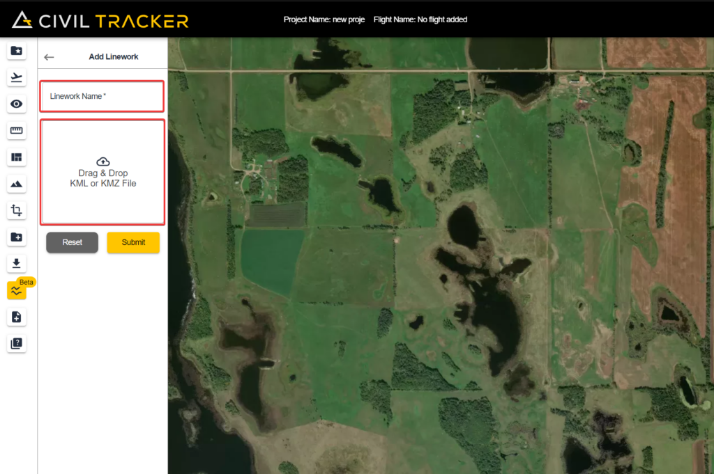
Please be aware that Linework is in Beta and you might run into a bug. If you do face a bug regarding linework, use our ticketing system to submit a ticket and our team will help fix it for you ASAP.
To make it even easier to get your data into Civil Tracker we’ve found some great videos and tutorials.
Export From AutoDesk Civil3D to KML/KMZ
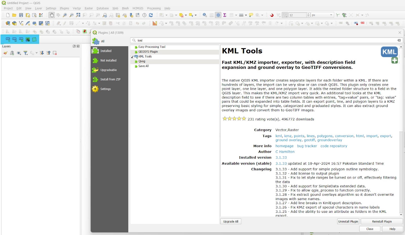
Export From QGIS to KML/KMZ
Save to KML/KMZ from Google Earth
We think adding the Linework tool to Civil Tracker hugely increases the value of our app for planning and building project. Thank-you to the numerous
Read more
Hill Plain’s Pioneering Journey with Civil Tracker
4 Tips for Better Winter Drone Mapping