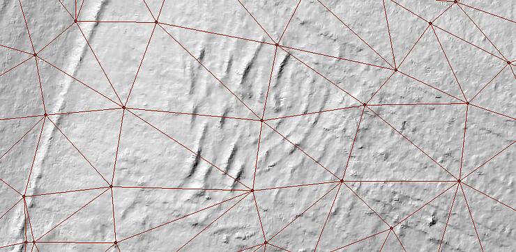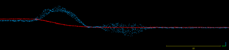
Achieving Repeatable Drone Surveys For Accurate Volumes
In the previous post we evaluated the accuracy a single drone data set and concluded it was excellent for earthworks. Once we have a single high quality data set we must focus on consistency. Maintaining…