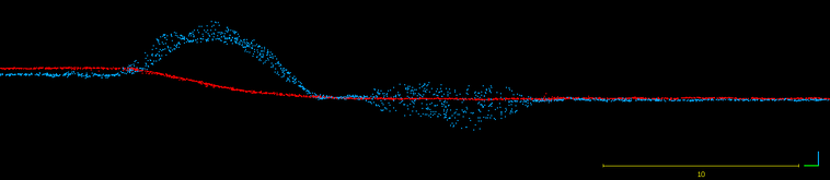
In the previous post we evaluated the accuracy a single drone data set and concluded it was excellent for earthworks. Once we have a single high quality data set we must focus on consistency. Maintaining repeatable results is extremely important for earthworks quantity tracking and progress reporting. Dozens or hundreds of flights may be conducted throughout the life of a project. A few centimeters of systematic drift in the data can skew quantity results by a large percentage.
We’ll explore 4 ways to ensure repeatable results throughout your project life. Each method has its advantages and disadvantages. The best method will depend on your experience, budget and project types.
Ground Control Points (GCP)
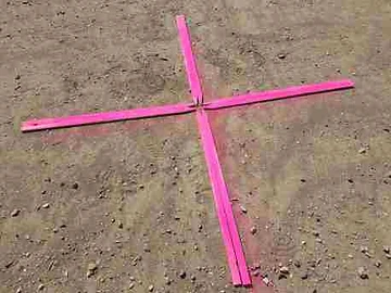
Using GCPs involves distributing targets throughout the project and surveying them to obtain precise coordinates. Coordinates are uploaded to the processing software. The entire drone data set is matched to the coordinates of the GCPs.
Pros: There is a reason this is by far the most common method used by drone operators. Using GCPs generates high-quality data and allows the for redundancy via independent checks. GCPs are cost effective for teams with GPS survey equipment. The only required hardware is a multi rotor drone and some homemade targets. Both of which are cheap.
Cons: There is a learning curve to properly distributing them, it takes extra time to layout and retrieve the GCPS, and finally if you don’t already have GPS it can be quite expensive to purchase.
Precise On-board GPS
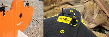
Higher end drones are built with precise on-board GPS. The precise GPS determines the camera location at the time the photo is taken to within a few centimeters. It’s important to never exclusively use on-board GPS. A diligent operator will always survey physical ground measurements and compare those measurements to that of the UAV data as an independent check.
Pros: This method is very time efficient in the field and allows for data acquisition of both large areas and areas that are hard to access on the ground and place GCPs.
Cons: Cost is the only downside to using this method of georeferencing of drone data. Precise GPS is required both in the drone and for redundant ground checks.
Permanent Ground Control Points
This solution is similar to the first presented. In this scenarios the GCPs are placed at the start of the project and remain untouched and undisturbed for the entirety of the project.
Pros: This solution is both accurate and low cost. A unique attribute is that the datasets are physically tied to each other. Theoretically this can achieve better results that either of the previous two scenarios.
Cons: Constraining GCPs to locations that will remain undisturbed could result in poor geometry of the GCPs. There is also the risk of GCPs being disturbed regardless of the efforts to protect them.
Co-Alignment

All of the previous methods use some means of correcting the drone data early in the stages of processing. An alternate is to align drone data-sets to each other after processing. Using objects and features that remain consistent data-sets can be manually and sometimes automatically aligned to each other.
Pros: This low cost solution has the advantages of being purely a software solution and the benefit of having the user engaged in the data.
Cons: The tools to co-align data-sets are not beginner friendly and earthworks projects often lack distinctive features that can be used for accurate alignment.
Conclusion
There is no one size fits all solution for ensuring repeatable drone data accuracy on your earthworks projects. Start by assessing the available equipment and expertise in your organization and follow that with an analysis of the number of projects you’ll be supporting, the size of the projects and the finally the duration. These factors will all be important in determining the best georeferencing method for your projects.