Congratulations on getting your drone pilot license. Ready to head out and fly? Before you go, you’ll want to assess the airspace around your flight area. It can be a little difficult the first few times. But, if you follow our process and use the tools we recommend you’ll have no trouble.
Why Assess Airspace When Planning A Drone Flights?
Determining the airspace classification is a key step in knowing if you are allowed to fly at all. It’ll also show whether the flight is a Basic or Advanced Operation. Finally Transport Canada and Nav Canada require that you assess airspace before flying your drone, so that you do not endanger yourself or anyone else.
How to Assess Airspace?
In the last few months I’ve settled on four go-to tools for mission planning. Use these tools to determine the following:
- What class of airspace will I be in?
- What aerodromes, heliports are close to my operation?
- Basic vs advanced operation?
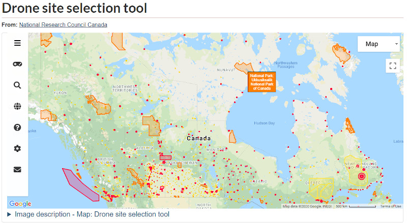
Drone Site Selection Tool
NRCAN and Transport Canada joined forces to create the Drone Site Selection Tool. It’s an interactive web map . If you’re only going to use one tool this is the one. The web map shows all registered aerodromes and heliports in Canada.

Sketching Your Flight Plan
Besides to displaying aerodromes and heliports you can do the following:
- Draw boundaries around your flight area.
- Set your pilot location.
- Measure distances from your planned operation to aerodromes.
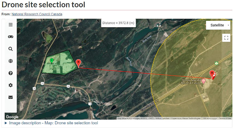
Consider using a screen capture as part of your Site Survey.
Understanding Yellow, Orange and Red Shapes
Empty space on the map represents uncontrolled class G airspace. Which is perfect for flying in. You’ll need to take a closer look at the the yellow, orange and red shapes.
Yellow Shapes
Some aerodromes and heliports are registered but not certified. These show up as yellow. You may conduct Basic Operations within these areas, but it isn’t recommended.
Orange Shapes
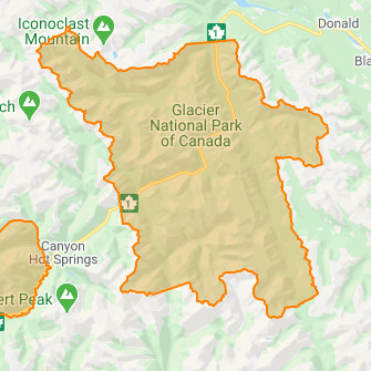
All the Orange shapes represent the National Parks. Parks Canada has banned recreational drone usage within the National Parks. You will need special permission to operate a drone in a National Park.
Ski hills and most provincial parks have also banned recreational drone operations. Yet, these areas don’t show up on the Drone Planning Tool. This is a good reminder not to rely on any single source of information.
Red Shapes
The red includes certified aerodromes, controlled airspace and restricted airspace. Requirements within the red areas vary. But all flights within red shapes need an Advanced Pilot Certificate, unless you’re operating a sub 250g microdrone.
If you haven’t completed your advanced exam check out our article on passing the Advanced Exam.
Class G airspace shown in red are Aerodromes and Heliports with Certificates. Contact the aerodrome to coordinate flight plans.
Restricted airspace is Class F. It shows up in red on the map. You must contact the listed organization to get permission to operate. Permission to operate may be denied.
Finally many of the areas in red are Controlled Airspace. Controlled Airspace can be class A, B, C, D or E. Complete a Flight Authorization Request through Nav Canada. (More on that later in this article.)
For a deeper dive into Airspace Classes check out Coastal Drones.
Basic or Advanced?
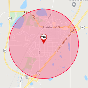
Use the site selection map to determine if you are conducting a Basic or Advanced operation. Basic Operations must be at least 5.6km from a Certified Aerodrome and 1.9km from a Certified Heliport.
- Basic operations can be conducted outside the yellow and red shapes on the map.
- Flying within a yellow filled area is discouraged. But, technically allowed with Basic Operations Category.
- If you’re within a red area on the map this will be an Advanced Operation.
Transport Canada and NRCAN are improving the tool. I expect it to become more comprehensive and user friendly over time.
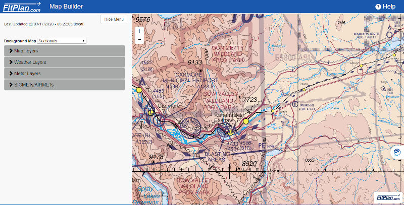
FltPlan
FltPlan has features within their website that are both free to use and useful. VFR Navigation Charts (VNCs) are available within FltPlan. These are the maps used by manned aircraft. VNC’s help pilots locate aerodromes, obstacles, and flight paths etc.
You can also find Aerodrome and heliport information within FltPlan. There are three items to look for. They are contact numbers for the facility, radio frequencies and traffic patterns.
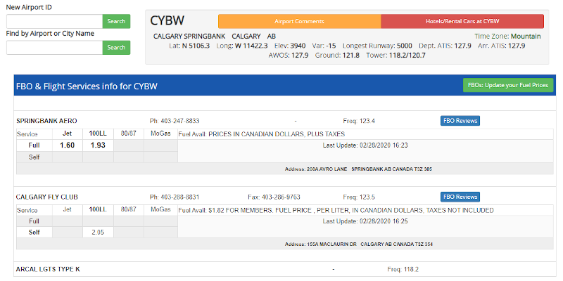
If your operation is in near an aerodrome or heliport it’s good practice to call the facility in advance. You should confirm that your flight won’t interfere with any manned aviation flights.
Nav Canada Drone Flight Planning
If I find that my proposed flight is within controlled airspace (class B, C, D or E) then I need NAV Canada authorization. This must be completed using NAV Drone. Be prepared to create an account, add your drone and enter all your information and flight details. Most approvals are instantaneous.
Zulu for Pilots
Retrieving NOTAMs (notice to airmen) is an important aspect of flight safety. The simplest way to check NOTAMs is through Zulu for Pilots. I expect its features and functionality to improve over time.
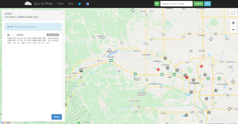
Using the website is quite simple. Retrieve NOTAMS by clicking on any aerodrome within the map.
Other Tools!
It’s exciting and intimidating to be part of the Canadian airspace, but as a drone pilot where you will be! The tools listed above help you follow the Canadian Aviation Regulations. By doing so you keep yourself, your drone and everyone else in the airspace safe!
There’s always new and better tools being made or ones that I’m unaware of. If you’ve made a tool or have a suggestion please join the conversation and help our community.