How Lethbridge Landfill enhanced their mapping missions using Civil Tracker
Introduction
The Waste & Recycling Centre (Lethbridge landfill) is a modern integrated waste management facility which serves the City of Lethbridge and the surrounding regions. Safe disposal, recycling and composting services are available for both residential and commercial customers.
The Waste & Recycling Centre is home to the following waste storage and processing facilities:
- Safe disposal at the non-hazardous waste landfill
- Public drop-off for garbage and recycling
- Hydro-vac waste disposal
- Impacted soil disposal
- Construction drop-off recycling area
- Recycling at the Material Recovery Facility
- Composting at the Organics Processing Facility
- The Blue sky Learning Center for school and 3rd party tours/outreach activities
Start of the journey
Lethbridge Landfill has been working with Civil Tracker for about 3 Years now. In these two years, Lethbridge has done around 50 flights over their landfill.
Before Civil Tracker, Lethbridge Landfill were using a local surveyor to survey their site twice in a year. That meant that they were only getting updated data once every 6 months which was less than ideal for a landfill. Once their operation grew, they knew that they wanted sometime a little more frequent and accurate.
Advanced Drone Hardware
Lethbridge Landfill employs the DJI Mavic 3 Enterprise drone, equipped with a mechanical shutter camera and an RTK module for centimeter-level precision, supported by a fixed base station. This setup ensures exceptional mapping efficiency. Civil Tracker, which ranks the Mavic 3 Enterprise as its top-performing RTK drone for mapping, has been integral to Hill Plain’s operations.
You can visit DJI website for further specs for the Mavic 3 Enterprise
Read more about the top performing mapping drones below
With the help of Civil Tracker, Lethbridge has been consistently flying their sites and getting quick and accurate data to plan their operations much more efficiently.

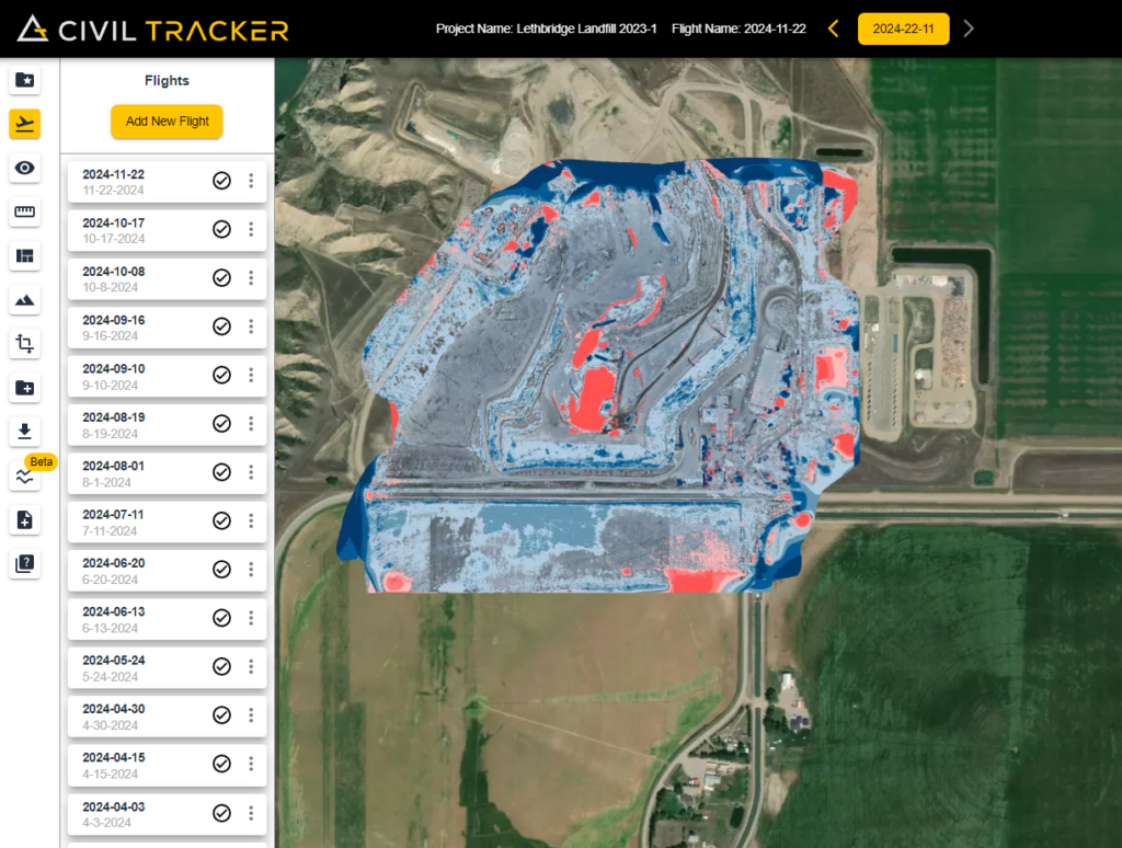
Lethbridge has been using the “cut-fill” feature to accurately measure their materials and making informed decision saving both time and money
Transforming Lethbridge Operations:
Since the start of their journey with Civil Tracker, Lethbridge Landfill has seen
- More frequent flights (about 80 flights per year)
- Huge decrease in the cost of surveys
- Safer surveys as the drone does most of the work
- Quick data turnaround time which helps in faster decision making
- Updated ortho imagery of their sites every week
Sign up now and take your mapping operations to new heights. We will be there every step of the way to ensure that you get the most out of your mapping missions
They Trust Us


