Skip to content
Civil Tracker
  • IndustriesExpand
    • Landfills and Waste Management
    • Aggregate Sand and Gravel
    • Municipal Services
    • Mining
  • ProductsExpand
    • How Civil Tracker Works
    • Ground Control Points as a Service
  • LearnExpand
    • Our Insights
    • Our Expertise
    • Our Technology
    • Support
  • Pricing
  • Contact
  • Login
  • Sign Up
Civil Tracker

InTheNews

Autel Nano and Nano+ Drone
InTheNews | Regulatory | Survey

Can I Map and Survey with the Autel Nano and Nano+

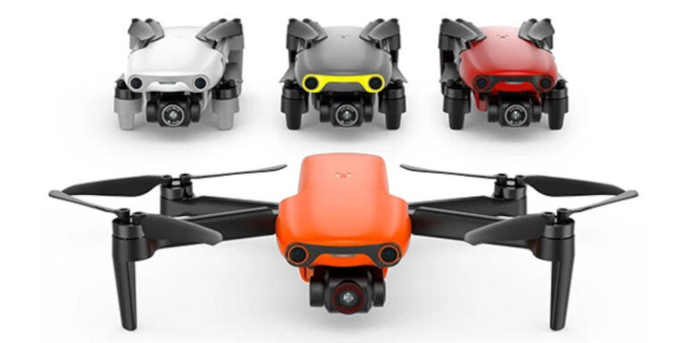
In September Autel Robotics announced their Autel Nano and Nano+ drone. The Autel Nano and Nano+ are two versions of a micro drone. Each weighs just under 250g and will compete with the DJI Mavic…

Read More Can I Map and Survey with the Autel Nano and Nano+Continue


Categories
  • Client Stories (4)
  • Drone (11)
  • Getting Started (5)
  • InTheNews (1)
  • Monitoring (7)
  • Regulatory (7)
  • Reporting (9)
  • ROI (5)
  • Support (9)
  • Survey (16)
  • Training (13)
  • Video (4)
  • Waste Management (3)

Does your surveyor have this view of your earthworks project? Now they can
Twitter Linkedin

© 2025 Civil Tracker

  • Privacy
  • Terms and Conditions
  • Industries
    • Landfills and Waste Management
    • Aggregate Sand and Gravel
    • Municipal Services
    • Mining
  • Products
    • How Civil Tracker Works
    • Ground Control Points as a Service
  • Learn
    • Our Insights
    • Our Expertise
    • Our Technology
    • Support
  • Pricing
  • Contact
  • Login
  • Sign Up
Twitter Linkedin