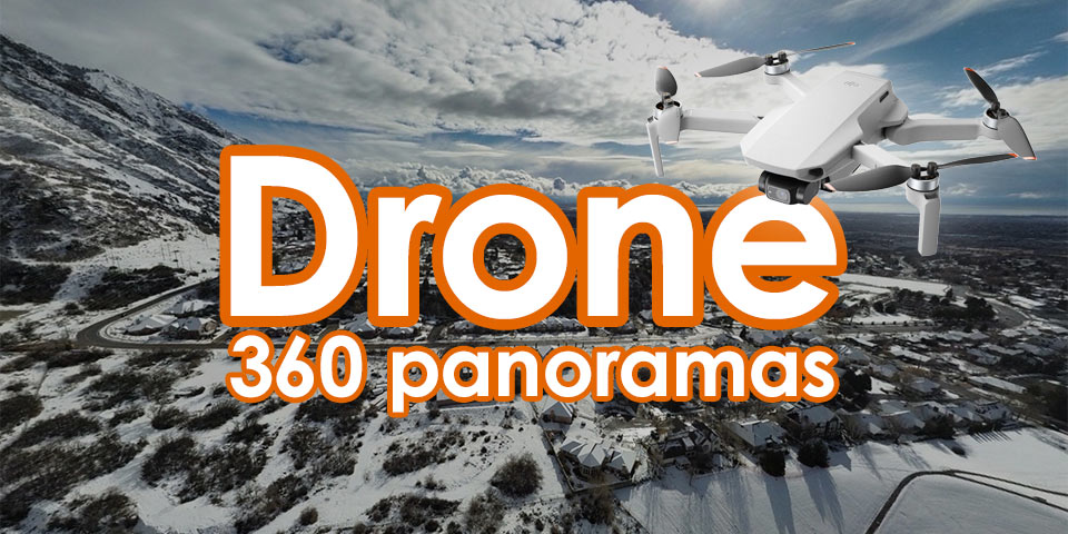
360 Panorama
A 360 panorama is an immersive image or photograph that covers the entire 360-degree field of view around the camera or viewpoint. It allows the viewer to look in any direction, creating the sensation of being in the center of the scene. These panoramas are often used in virtual tours, real estate showcases, landscapes, or even VR experiences.
Panoramas play a significant role in mapping, particularly in enhancing the detail, accuracy, and user experience of geographic information systems (GIS) and digital maps. Here’s how panoramas contribute to mapping:
Enhanced Visualization
- Immersive Experience: Panoramic images allow users to explore environments in an immersive way, providing a 360-degree view of a location. This is valuable for geographic exploration and understanding the spatial relationship between landmarks and features in a natural environment.
- Street Views: Panoramic street views, like those used in Google Maps and other navigation platforms, allow users to virtually visit places, aiding in navigation and planning.
Detailed Context
- Real-world Reference: Panoramic mapping provides detailed visual context that is missing in standard 2D maps. For instance, users can see surrounding buildings, landscape features, and terrain, making it easier to understand the environment without visiting the location physically.
- Environmental Documentation: Panoramas capture details of the surrounding environment that are useful for urban planning, environmental studies, or disaster management.
Accurate Data Collection
- Geospatial Accuracy: Modern mapping systems use panoramic imagery for more accurate data collection. High-resolution panoramic cameras mounted on drones, cars, or satellites help gather precise geospatial data for creating 3D models, topographical maps, and geographic visualizations.
- Real-time Updates: Panoramic technology can be used to update maps in real time, providing the most current information about infrastructure, land use, or even traffic.
Tourism and Real Estate
- Virtual Tours: Panoramic images are often used to create virtual tours for landmarks, cities, and real estate properties. This makes them valuable for tourism industries and real estate mapping, where potential visitors or buyers can explore locations from anywhere in the world.
- Cultural Preservation: Panoramic mapping helps document cultural heritage sites, offering a virtual experience of historical places, which is crucial for preservation and educational purposes.
3D Mapping and GIS
- 3D Models: Panoramic imagery is integral to creating 3D models of landscapes, cities, and even interiors. In mapping, these 3D models provide a realistic representation of physical spaces, helping professionals in urban planning, architecture, and geospatial analysis.
- GIS Integration: Geographic Information Systems (GIS) often integrate panoramic views into their datasets, allowing for better analysis of geographic data in relation to the physical environment.
Improved Navigation and Location Services
- Enhanced Wayfinding: Panoramic images are useful in navigation services, making it easier for users to find specific locations or landmarks, especially in complex urban settings.
- Driver Assistance Systems: Panoramic mapping is used in advanced driver assistance systems (ADAS) for vehicles, where the technology helps cars navigate by providing a more comprehensive view of the surroundings.
How 360 Panorama works
After you upload your panorama image in your flight, you will see these images (based on location) as red dots on top of your ortho
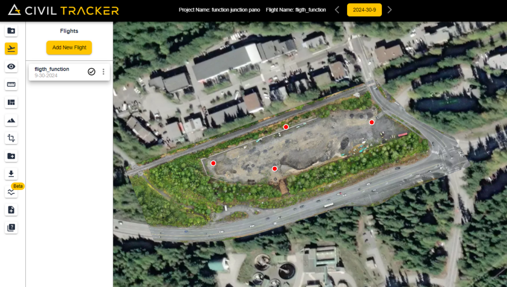
To go into the panorama image, simply click on the red dot and your panorama image will load. Here is a short tutorial on how to use the panorama image
Sign up now to start using the panorama view

Speed

Survey 10 times faster than GPS. Get results in hours, not days.
They Trust Us