How to Create Permanent Drone Ground Control Points
Why Permanent Ground Control Points?
Ground Control Points are key to accurate and repeatable drone mapping. Typically Ground Control Points are temporarily placed by a surveyor and then removed after the drone flight.
But, permanent ground control points save significant time and cost for many pilots. Not to mention the increased accuracy of permanent ground control.
Ground Control Point Basics
Permanent Ground Control should meet a handful of criteria.
- Durable
- Placed in areas where they will not be disturbed
- Visible in drone pictures
We always recommend a minimum of 5 located within the flight area. But, if possible place a Ground Control Point near the highest and lowest point of the flight area.
Materials
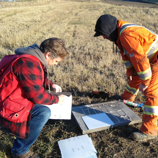
Sidewalks and asphalt are both good bases for permanent GCPs. But, many projects are far removed from the urban environment. For most 24″ x 24″ patio blocks provide the best base.

You will need to create a black and white checkered pattern on the GCP. Then, the center of the GCP can be accurately surveyed and detected in the aerial images.
Create the checker pattern by using paint or vinyl flooring tiles. A little construction glue (such as PL400) will help ensure that the vinyl tiles stay put.
How Many Ground Control Points Are Required?
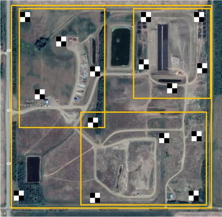
At lease 5 GCPs are required per flight area. On a 160acre project size we will often place up to 15 GCPs to provide the pilot with flexibility to fly the entire site or smaller areas of the project.
The example below shows the proposed location for 15 permanent ground control points on a 160 acre landfill. The strategic placement of the points allows the pilot flexibility to fly various key areas shown in yellow.
Surveying Permanent Ground Control Points
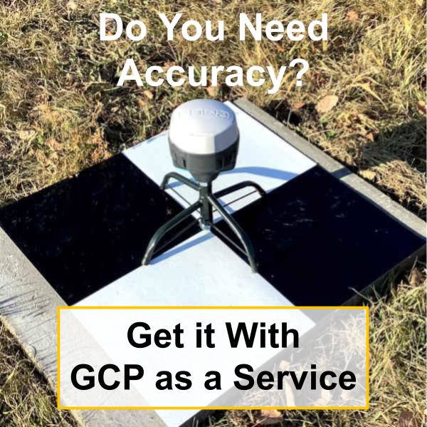
If you have RTK GCPs then that will be the best way to survey your Ground Control Points. However, if you do not have your own equipment take a look at Civil Tracker’s unique service that provides high accuracy coordinates for your Ground Control Points.
For more information on GCPs check out our All about Ground Control Points post.